Kartoza is an official partner of Mergin Maps. We provide full Mergin Maps services, including
- campaign design and implementation
- training
- support
- integrations
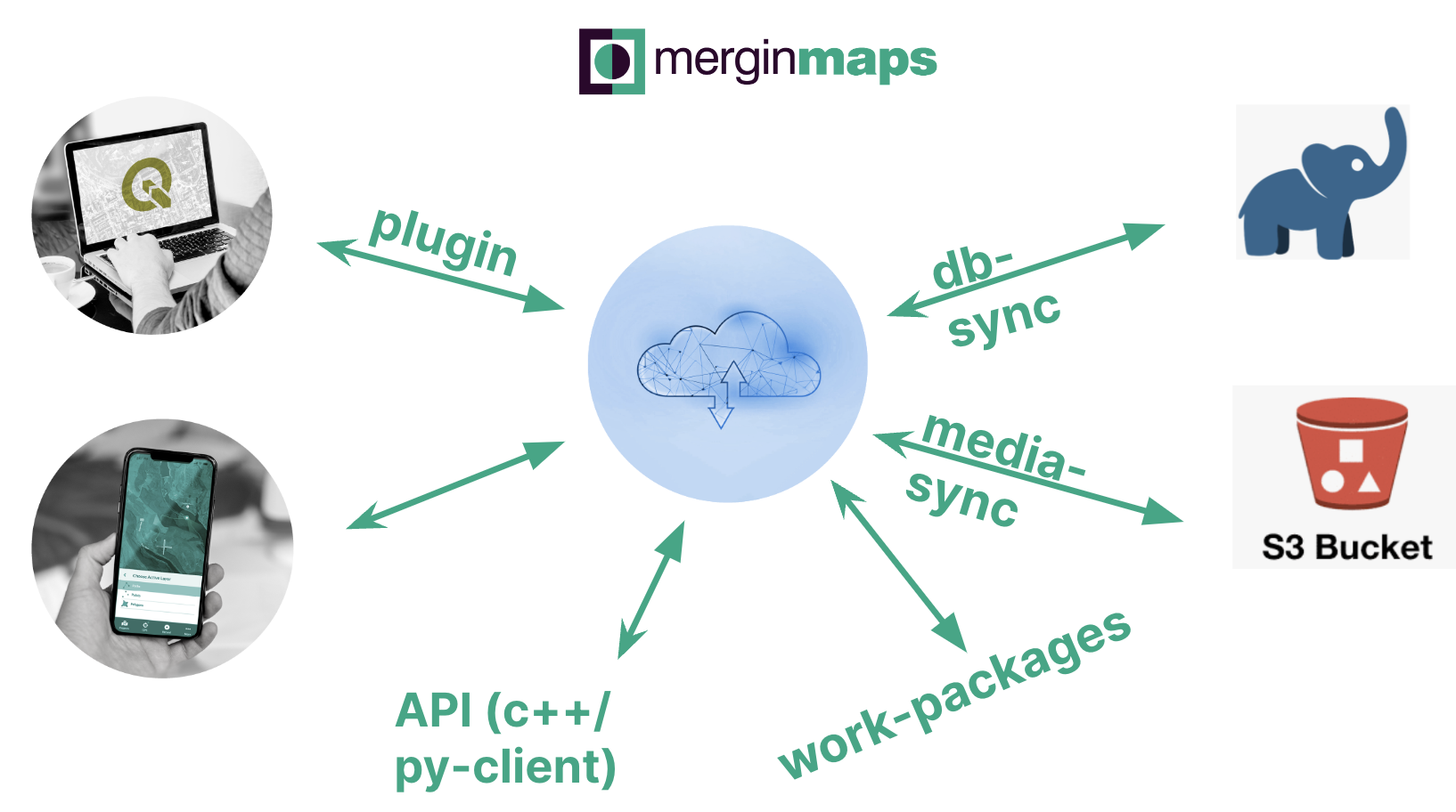
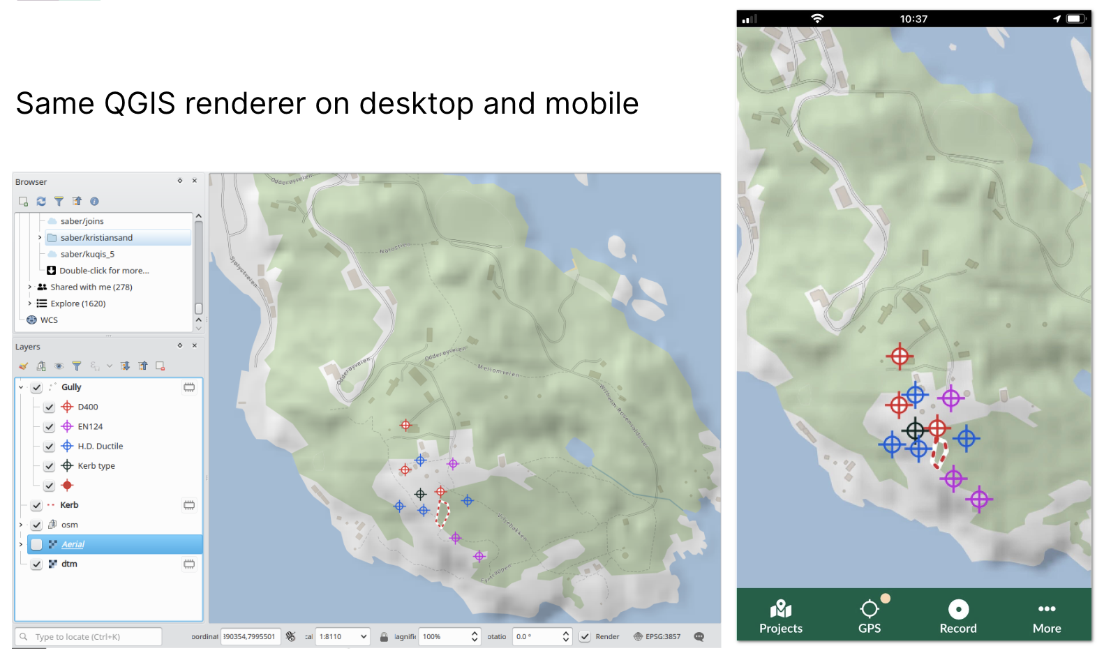
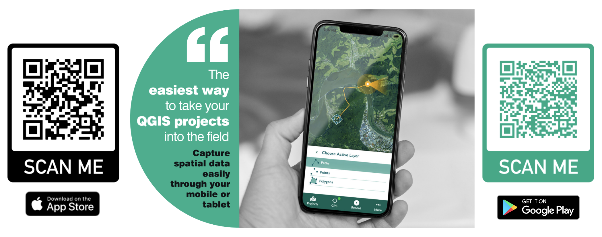
Mergin Maps is a field data collection solution with desktop (QGIS), mobile app (iOS, Android and Windows) and cloud components. It is very easy to use:
- Design your campaign in QGIS by composing a map and designing a form
- Sync your project via Mergin Maps cloud to users who have the Mergin Maps app
- Collect field data and sync back!
Feature highlights
- Full-featured forms functionality (data types, defaults, constraints, validation, dropdowns, dependent fields, conditional visibility etc.)
- Full automated and visual diff and conflict control and management
- Geodata handling from basic point capture to polygon capture and editing including splitting and snapping
- Field navigation and stake-out tool
- Increase positional accuracy with external GNSS
- Selective media sync and auto-resizing and third-party storage for campaigns with lots of images
- Sub-tasking campaigns to workgroups
- Full change history logged, including versioning and backups
- Work online or offline
Use any data format, including:
- Vector Tiles
- Raster Tiles
- COGs and other online sources
- Rasters
- PostgreSQL / PostGIS
- GeoPackage
- Shapefiles
Samples of Kartoza Mergin Maps experience
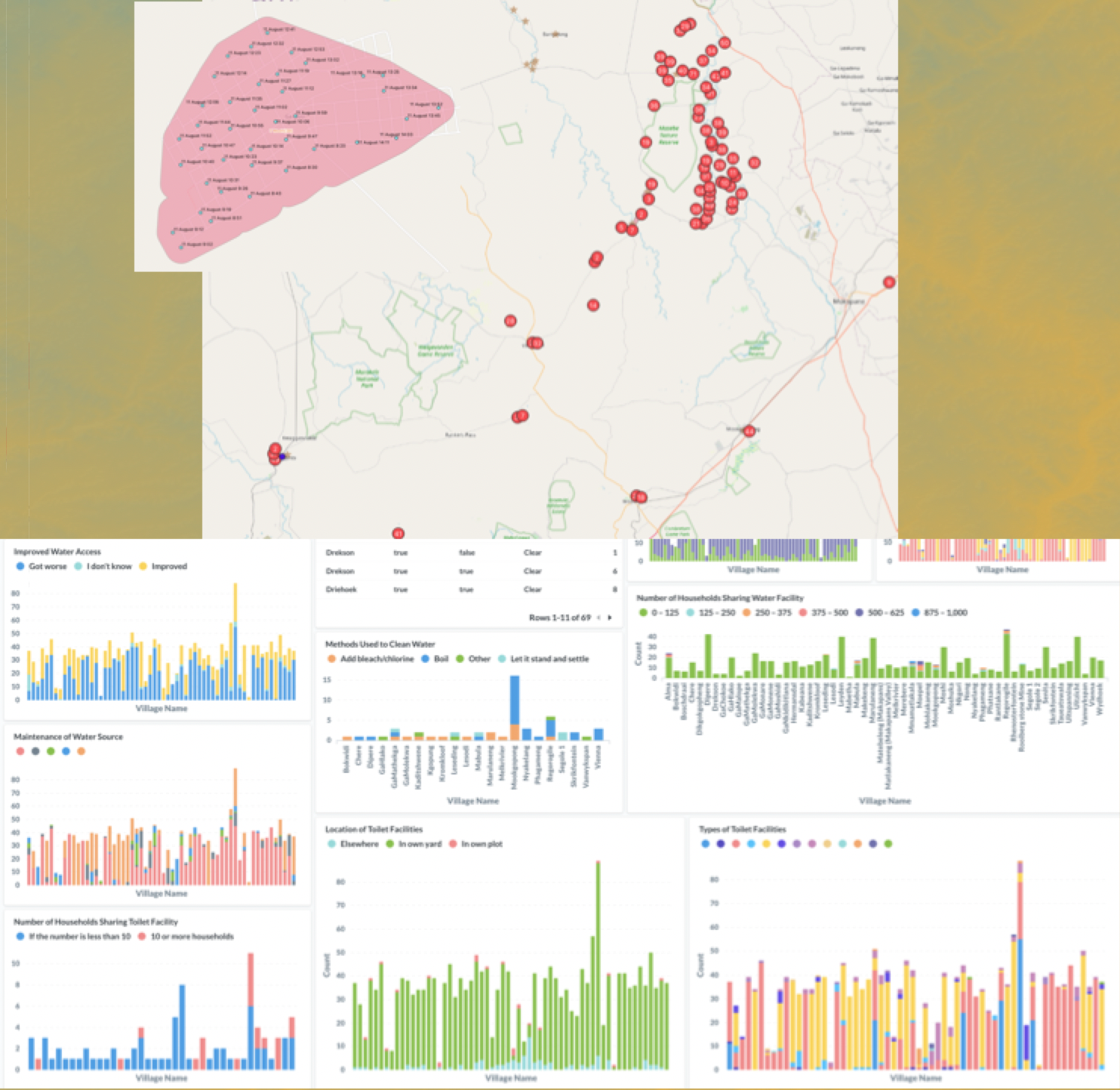
The graphic below shows a WASH survey we supported in 2020 for the Waterberg Biosphere Reserve (funded by USAID Resilient Waters). Three field workers surveyed 2000 people in sixty villages in the Waterberg District of Limpopo Province in South Africa.
The map shows the distribution of villages, the inset map shows interview locations within one village and the charts show live data visualisations we set up in Metabase, linked to a PostgreSQL cloud database being updated automatically with data coming in from the field, via the mergin-db-sync utility.