Kartoza - Data Defined Settings for Grid Placements in QGIS 3.12
For a while now I have been trying to simulate the 1in50k topographic maps of South Africa.
For a while now I have been trying to simulate the 1in50k topographic maps of South Africa. I started using QGIS since version 1.8 and I couldn't replicate the cartography on the topographic maps but over time as QGIS has matured, I could replicate the NGI maps. NGI uses proprietary software and then Adobe to fine-tune some context on the maps. For this exercise I used QGIS 3.12.0
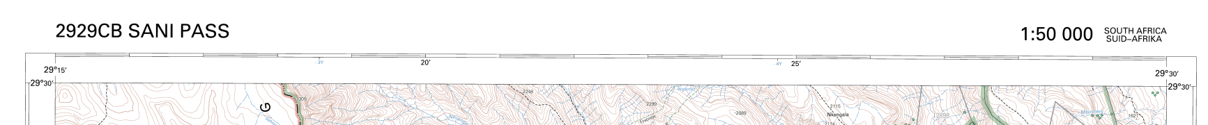
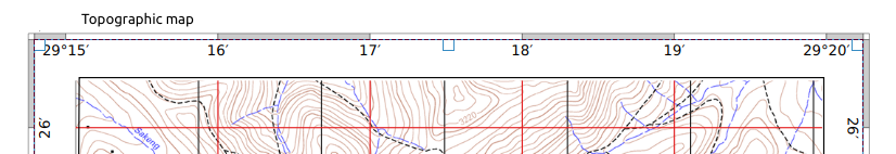
The goal of the exercise was to emulate the grid labels for the topographic maps as depicted below.
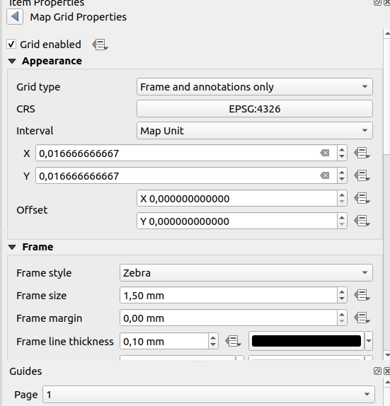
I navigated to the map composer and added my grid with the following properties.
In labeling, I choose custom settings and then used the following formulae
CASE
     WHEN  @grid_axis = 'x' THEN
          IF (  to_dm(  @grid_number , 'x', 0) != to_dm( x(transform( point_n( @map_extent , 1), 'EPSG:3857', 'EPSG:4326' )), 'x', 0),
          IF (  to_dm(  @grid_number , 'x', 0) != to_dm( x(transform( point_n( @map_extent , 2), 'EPSG:3857', 'EPSG:4326' )), 'x', 0),
          right(to_dm(  @grid_number , 'x', 0),3), to_dm(  @grid_number , 'x', 0)) , to_dm(  @grid_number , 'x', 0))

    WHEN @grid_axis = 'y' THEN
         IF (  to_dm(  @grid_number , 'y', 0) != to_dm( y(transform( point_n( @map_extent , -4), 'EPSG:3857', 'EPSG:4326' )), 'y', 0),
        right(to_dm(  @grid_number , 'y', 0),3), to_dm(  @grid_number , 'y', 0))
END
To breakdown the functions
- We get the grid axis we need to label using the expression
@grid_axis = 'x' - We then get the grid number of the graticule and we compare it to the starting point of the geometry of the grid which we find using the expression
point_n( @map_extent , 1) - If the values are equal we then label the grid using the decimal value for the grid. If not then we label using the minutes for the grid.
- To get the second corner coordinate we us the expression
point_n( @map_extent , 2)which gives us the geometry of the point at the second position of the polygon extent of the map. - We nest the if functions so that we can get the function listed above.


No comments yet. Login to start a new discussion Start a new discussion