Blog
Zonal Operations using PostGIS
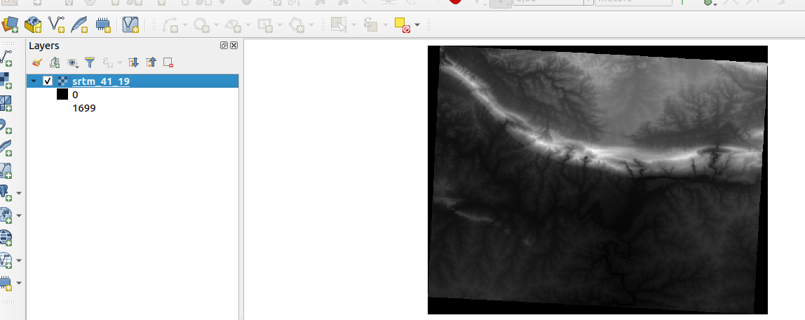
Interactions with remote datasets from Cloud storage providers opens up many possibilities
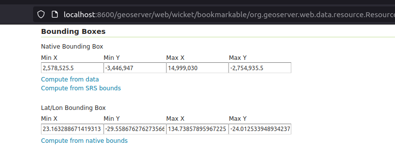
Tutorial: Auto-updating GeoServer layer configurations
GeoServer REST API enables remote interactions with GeoServer, thereby enhancing automation

Kartoza at PyConZA Durban 2023
Kartoza is actively involved in developing cutting edge geospatial solutions. Python programming language is at the heart of the major products we build.
.png)
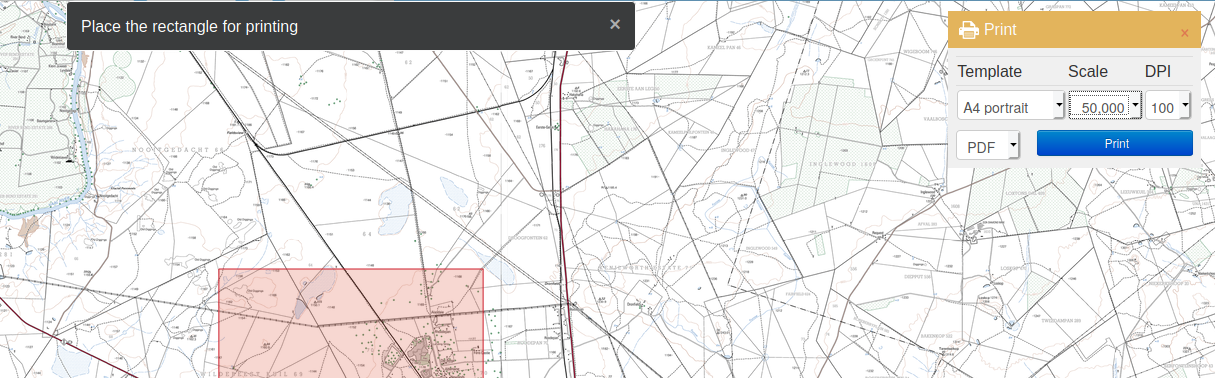
GIS in the classroom - Exploring the SAGTA Map Downloader
GIS is part of the school Geography curriculum in South Africa. Teachers need to grasp GIS concepts and teach them in the classroom. Geography teachers and students often need access to topographical
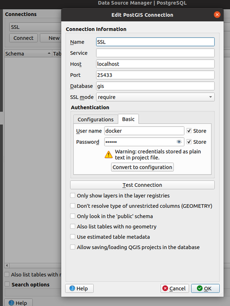
Collaborating on a QGIS Project Saved in a PostgreSQL Database
QGIS provides a couple of options when it comes to working with QGIS projects. All these formats have their strengths and weakness. When doing some work in QGIS we used to share around the QGIS projec
PostgreSQL SSL Setup in Docker-postgis
There are many ways to get a running PostgreSQL database on your host machine. Our preferred method of setting up the the database is using Docker and Kartoza provides a PostGIS Docker image
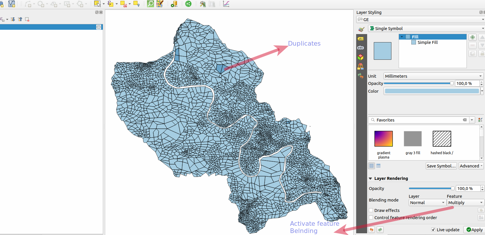
Finding and Fixing Topology and Geometry Errors in QGIS
Google Maps, Google Earth, Uber are examples leading software/apps that are driven by GIS. They have allowed the ordinary person inadvertently to use GIS and appreciate its power without needing an un
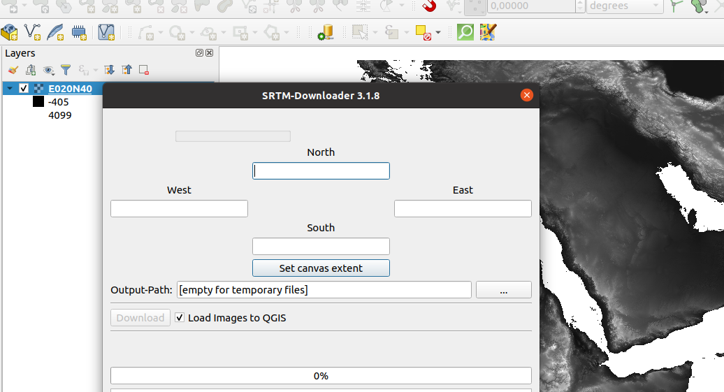
Publishing Digital Elevation in Cesium
Digital elevation data is now readily available from multiple sources. There are several tools that can help to visualise elevation data, Cesium being one.
Calculating Area of Rasters in QGIS
QGIS raster functionality has come a long way and continues to improve.
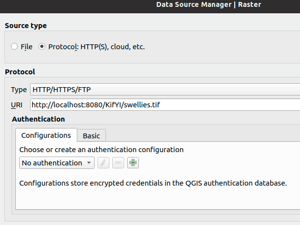
Consuming Cloud Optimised GeoTIFFs in QGIS Server
QGIS has been able to consume cloud optimised GeoTIFFs (COGs) since v3.2, through the data source manager.
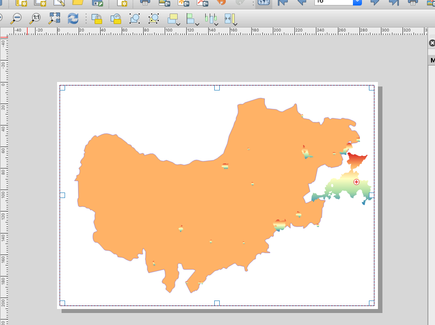
Create a Custom Reference Grid in QGIS Composer (Part 2)
This is a follow-up post on https://kartoza.com/en/blog/create-a-custom-reference-grid-in-qgis-composer/.
Data Defined Settings for Grid Placements in QGIS 3.12
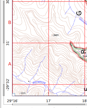
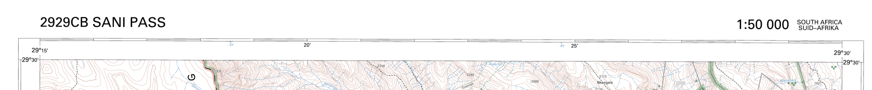
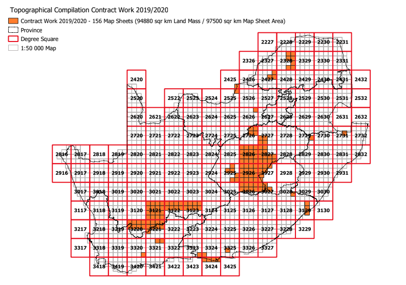
For a while now I have been trying to simulate the 1in50k topographic maps of South Africa.
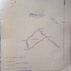
Calculating Intersects for Map Layers and Map Extent Dynamically in QGIS
Recently we have been working on a project that involves simulating the 1 in 50k topographic maps in South Africa.
Batch Count Vector Features Intersecting Series of Blocks in PostgreSQL
The national mapping agency in South Africa (NGI ) caters for national mapping, digital topographic and other Geo-Spatial Information services.
Show Only Features Within Current Atlas Feature - QGIS 3
In our endless endeavour to spread QGIS, I was invited to conduct QGIS training at the Surveyor General Department in Swaziland.
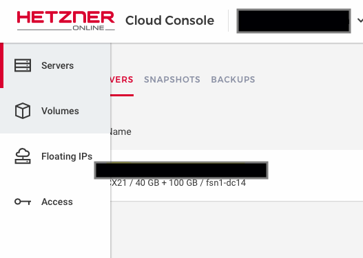
Mounting a Storage Drive in Hetzner Cloud for Rancher Deployments
This article builds upon an earlier blog post by Tim Sutton on using-a-sambacifs-mount-as-a-docker-volume.
Setting up Geogig in a Production Environment
GIS practitioners and developers have long been interested in versioning spatial data.
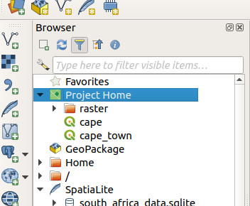
Some QGIS 3 Browser Improvements - Small Things Matter
Well, QGIS 3 has been out for a couple of weeks now with lots of new functionality.

An Intern's Perspective on Her Working Experience at Kartoza During the Summer Vacation
As a leading Open Source GIS company, Kartoza aims to introduce people and organisations to the world of Open Source GIS in South Africa.
A New Plugin to Manage Land (survey) Parcels in QGIS
Kartoza releases the CoGo Plugin for QGIS


